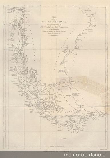
Mapa de una parte de Sud América, realizado por la expedición inglesa de Parker King entre los años 1826-1830
Narrative of the surveying voyages of his Majesty's ships Adventure and Beagle between the years 1826 and 1836 describing their examination of the sourthern shores of south America and the beagles circumnavegation of the globe. London: Henry Colburn, 1839, tomo I


Clasificaciones
Propiedad intelectual: Patrimonio cultural común
Tipo: Mapa
1 mapa
Lámina entre las páginas 462-463
Leyenda: Chart of a part of South America, Surveyed by order of The ... or the Admirabtly Under the Direction of Capt. P.P. King RN. During the Years 1826-30
En borde inferior derecho: Engraved by J. Gardner
En borde inferior al centro: Published by Henry Colburn, Great Marlborough Street. 1839
Año: 1839
Idioma: Inglés
Colección: Biblioteca Nacional de Chile
Códigos BN: MC0012186
N° sistema: 71669
Temas relacionados:
Este documento pertenece al patrimonio cultural común, por lo que puede ser utilizado y reproducido libremente.